Product information
€11.99
Stock: In Stock Online
Our USPs

- Free DeliveryExtended Range: Delivery 3-4 working days

- Dubray RewardsEarn 48 Reward Points on this title
Philadelphia Street Map
Product information
Author:
Type: Book
ISBN: 9780528028786
Date: 16th October, 2024
Publisher: Rand McNally
Categories
- Travel Maps
Description
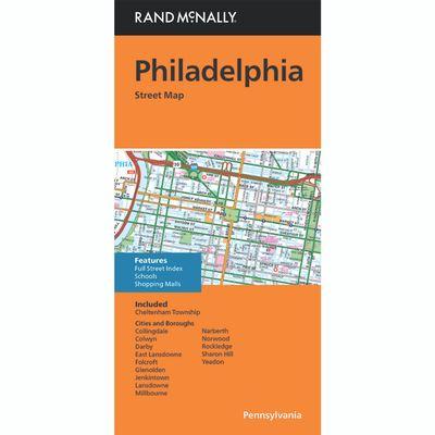
Rand McNally's folded map for Philadelphia is a must-have for anyone traveling in and around this part of Pennsylvania, offering unbeatable accuracy and reliability at a great price.
Our trusted cartography shows all Interstate, U.S., state, and county highways, along with clearly indicated parks, points of interest, airports, county boundaries, and streets. The easy-to-use legend and detailed index make for quick and easy location of destinations. You'll see why Rand McNally folded maps have been the trusted standard for years.
- Regularly updated.
- Full-color maps.
- Clearly labeled Interstate, U.S., state, and county highways.
- Indications of parks, points of interest, airports, county boundaries, schools, shopping malls, downtown & vicinity maps.
- Easy-to-use legend.
- Detailed & full street index.
- Convenient folded size.
Coverage Area Communities Included: Cheltenham, Collingdale, Colwyn, Derby, East Lansdowne, Folcroft, Glenolden, Jenkintown, Lansdowne, Millbourne, Narberth, Norwood, Rockledge, Sharon Hill, Yeadon plus downtown enlargement.
Product Details: Measures 9.5' x 4' and folds out to 40' x 28'.